ZCZC MIATWOAT ALL
TTAA00 KNHC DDHHMM
Tropical Weather Outlook
NWS National Hurricane Center Miami FL
200 AM EDT Sun Aug 15 2021
For the North Atlantic...Caribbean Sea and the Gulf of Mexico:
The National Hurricane Center is issuing advisories on Tropical
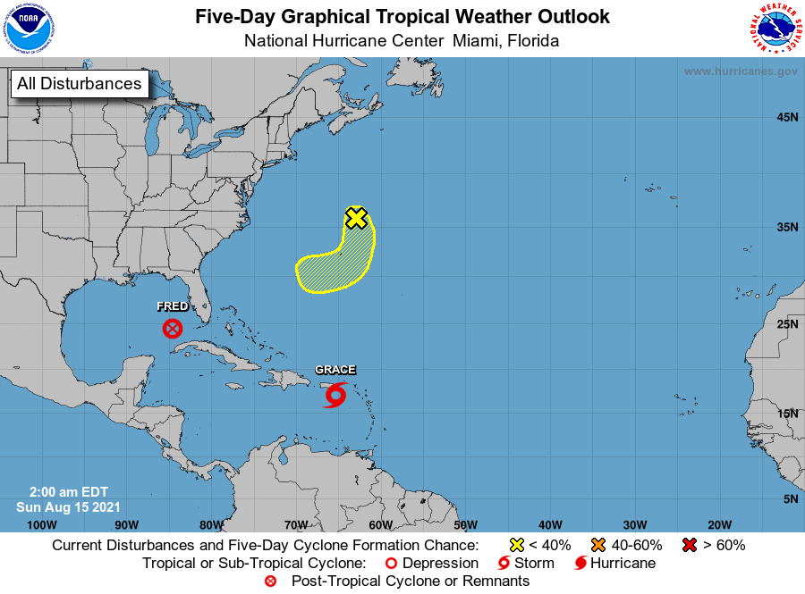
Storm Grace, located over the northeastern Caribbean Sea just to
the southeast of Puerto Rico.
The National Hurricane Center is issuing advisories on the Remnants
of Fred, which are expected to re-generate into a tropical cyclone
over the southeastern Gulf of Mexico later today.
* Formation chance through 48 hours...high...90 percent.
* Formation chance through 5 days...high...90 percent.
1. A small but well-defined low pressure system located about 200 miles
north-northeast of Bermuda is producing disorganized showers and
thunderstorms mainly to the south and southwest of the center. Some
gradual development is possible over the next couple of days while
the system moves slowly southward near or to the east of Bermuda. By
Tuesday, however, environmental conditions are forecast to become
less conducive for tropical cyclone formation.
* Formation chance through 48 hours...low...30 percent.
* Formation chance through 5 days...low...30 percent.
Forecaster Stewart