ZCZC MIATWOAT ALL
TTAA00 KNHC DDHHMM
Tropical Weather Outlook
NWS National Hurricane Center Miami FL
800 PM EDT Sat Aug 14 2021
For the North Atlantic...Caribbean Sea and the Gulf of Mexico:
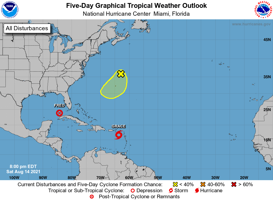
The National Hurricane Center is issuing advisories on Tropical
Storm Grace, located just north of Guadeloupe.
The National Hurricane Center is issuing advisories on the
Remnants of Fred which are expected to re-generate into a tropical
cyclone over the southeastern Gulf of Mexico tonight or Sunday.
* Formation chance through 48 hours...high...90 percent.
* Formation chance through 5 days...high...90 percent.
1. A small area of low pressure associated with disorganized showers
and thunderstorms has developed more than 200 miles north-northeast
of Bermuda. Some gradual development is possible over this weekend
into early next week as this system drifts slowly southward near
Bermuda over the next few days.
* Formation chance through 48 hours...low...20 percent.
* Formation chance through 5 days...low...30 percent.
Forecaster Papin/Brown