ZCZC MIATWOAT ALL
TTAA00 KNHC DDHHMM
Tropical Weather Outlook
NWS National Hurricane Center Miami FL
200 PM EDT Thu Aug 12 2021
For the North Atlantic...Caribbean Sea and the Gulf of Mexico:
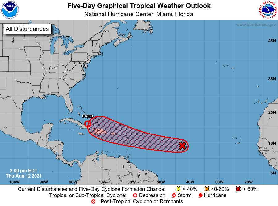
The National Hurricane Center is issuing advisories on Tropical
Depression Fred, located about 105 miles west of Great Inagua,
Bahamas.
1. Satellite-derived wind data from this morning indicated that a
small area of low pressure has developed along a tropical wave
about 1200 miles east of the Lesser Antilles. However, the low
does not quite have a closed circulation, and the associated shower
and thunderstorm activity remains disorganized. Environmental
conditions are expected to become more conducive for additional
development, and a tropical depression is likely to form by the
weekend while moving generally westward at about 20 mph across the
tropical Atlantic. This system is expected to reach portions of the
Leeward Islands late Saturday or early Sunday, and interests there
should monitor its progress.
* Formation chance through 48 hours...medium...60 percent.
* Formation chance through 5 days...high...70 percent.
Forecaster Berg