ZCZC MIATWOAT ALL
TTAA00 KNHC DDHHMM
Tropical Weather Outlook
NWS National Hurricane Center Miami FL
200 PM EDT Fri Aug 6 2021
For the North Atlantic...Caribbean Sea and the Gulf of Mexico:
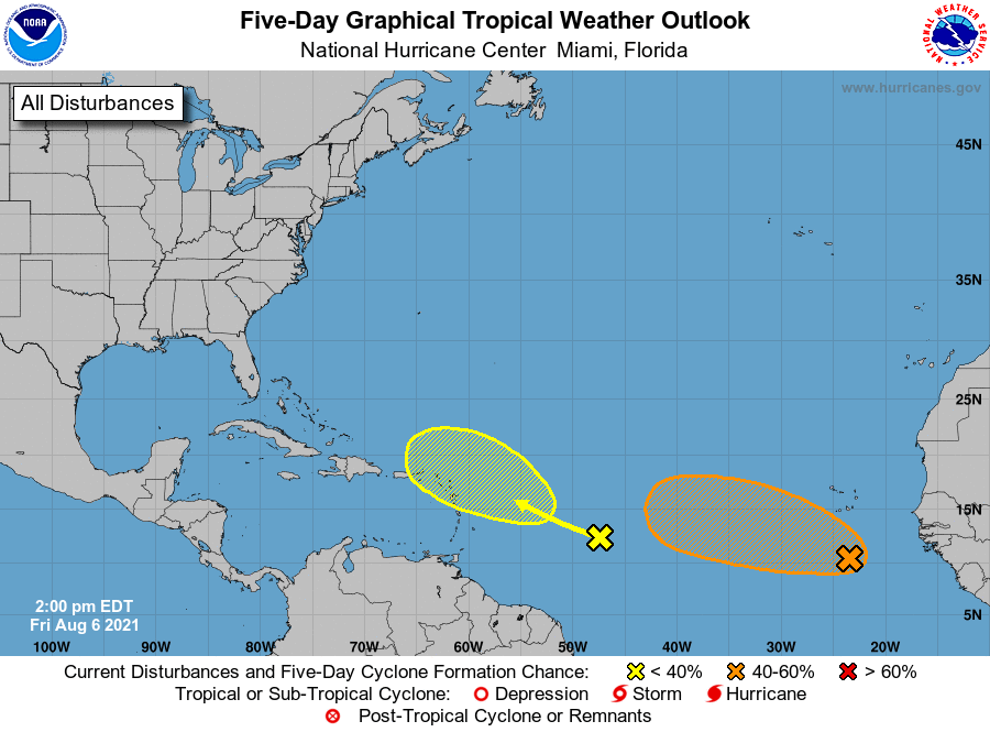
1. A large area of disorganized cloudiness and showers located a few
hundred miles south of the Cabo Verde Islands is associated with
a tropical wave and an associated broad area of low pressure.
Environmental conditions appear somewhat conducive for gradual
development over the next several days, and a tropical depression
could form late this weekend or early next week while the system
moves generally west-northwestward across the tropical Atlantic.
* Formation chance through 48 hours...low...30 percent.
* Formation chance through 5 days...medium...60 percent.
2. A tropical wave located over the west-central tropical Atlantic
is producing limited shower activity. Development, if any, of this
system is expected to be slow to occur as it moves west-
northwestward and approaches the Lesser Antilles early next week.
* Formation chance through 48 hours...low...near 0 percent.
* Formation chance through 5 days...low...20 percent.
Forecaster Brown/Hagen