Skip Navigation Links
NOAA NOAA United States Department of Commerce

NHC Graphical Outlook Archive


« Earliest Available         ‹ Earlier         Later ›         Latest Available »
GIS Shapefiles
Central Pacific Eastern Pacific Atlantic

View 2-Day Graphical Tropical Weather Outlook
Click for Eastern Pacific Click for Eastern Pacific

Tropical Weather Outlook Text

ZCZC MIATWOAT ALL
TTAA00 KNHC DDHHMM

Tropical Weather Outlook
NWS National Hurricane Center Miami FL
800 PM EDT Mon Aug 2 2021

For the North Atlantic...Caribbean Sea and the Gulf of Mexico:

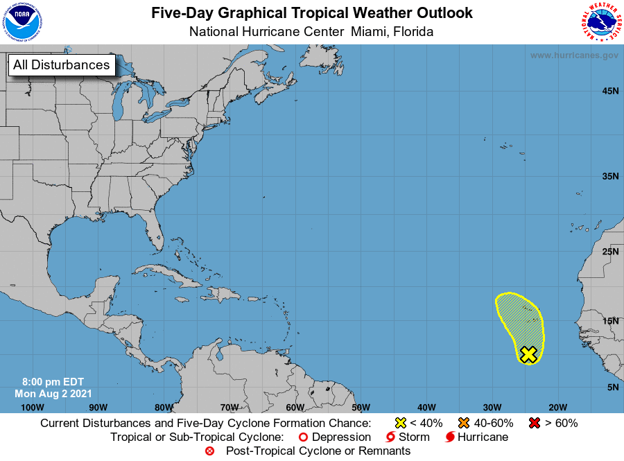
1. A surface trough of low pressure over the far eastern Atlantic Ocean 
located a few hundred miles south of the Cabo Verde Islands is 
producing disorganized showers and thunderstorms.  Some slow 
development of this system is possible during the next couple of 
days while it moves northward or northwestward before the system 
moves over cool waters by Thursday.  Locally heavy rainfall and 
gusty winds are possible over portions of the Cabo Verde Islands 
through Wednesday.
* Formation chance through 48 hours...low...10 percent.
* Formation chance through 5 days...low...20 percent.

Forecaster Pasch


List of Atlantic Outlooks (May 2023 - present)
List of East Pacific Outlooks (May 2023 - present)
List of Central Pacific Outlooks (May 2023 - present)
List of Atlantic Outlooks (July 2014 - April 2023)
List of East Pacific Outlooks (July 2014 - April 2023)
List of Central Pacific Outlooks (June 2019 - April 2023)
List of Atlantic Outlooks (June 2009 - June 2014)
List of East Pacific Outlooks (June 2009 - June 2014)