ZCZC MIATWOAT ALL
TTAA00 KNHC DDHHMM
Tropical Weather Outlook
NWS National Hurricane Center Miami FL
200 PM EDT Sat Jul 24 2021
For the North Atlantic...Caribbean Sea and the Gulf of Mexico:
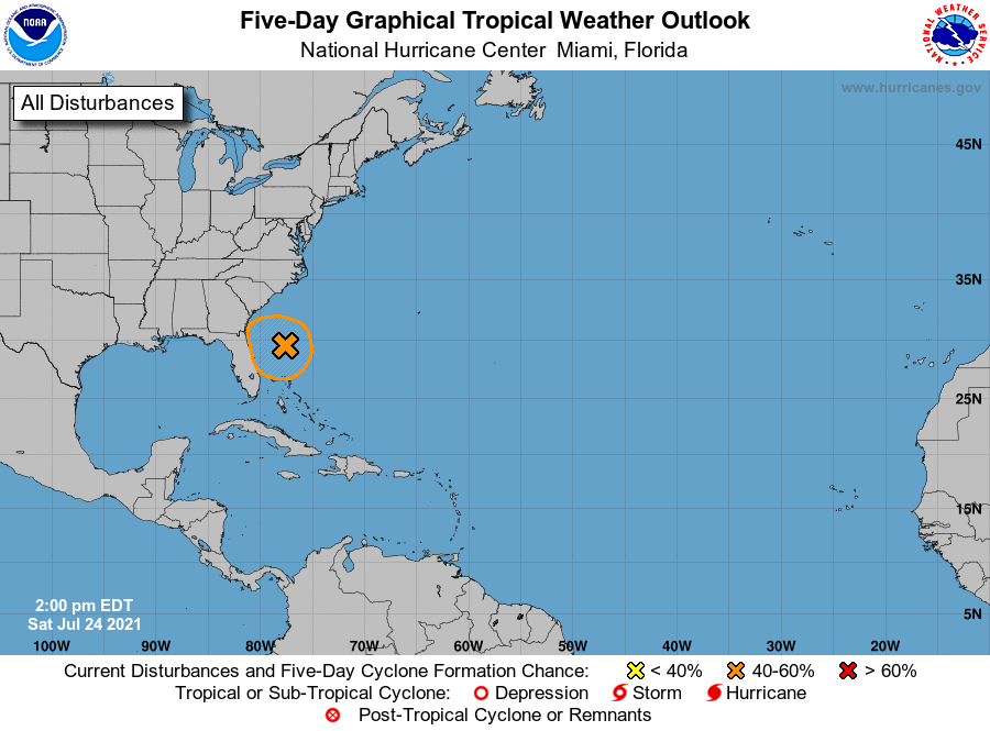
1. Showers and thunderstorm activity remain disorganized in association
with the low pressure system located about 200 miles east of Daytona
Beach, Florida. Environmental conditions appear only marginally
conducive for additional development, but a tropical depression
could still form over the next day or so while the low drifts
westward towards the Florida Peninsula. Interests in Florida should
continue to monitor the progress of this system. An Air Force
Reserve Hurricane Hunter aircraft is en route to investigate the
system further.
* Formation chance through 48 hours...medium...60 percent.
* Formation chance through 5 days...medium...60 percent.
Forecaster Papin/Beven