ZCZC MIATWOAT ALL
TTAA00 KNHC DDHHMM
Tropical Weather Outlook
NWS National Hurricane Center Miami FL
800 PM EDT Sun Jun 27 2021
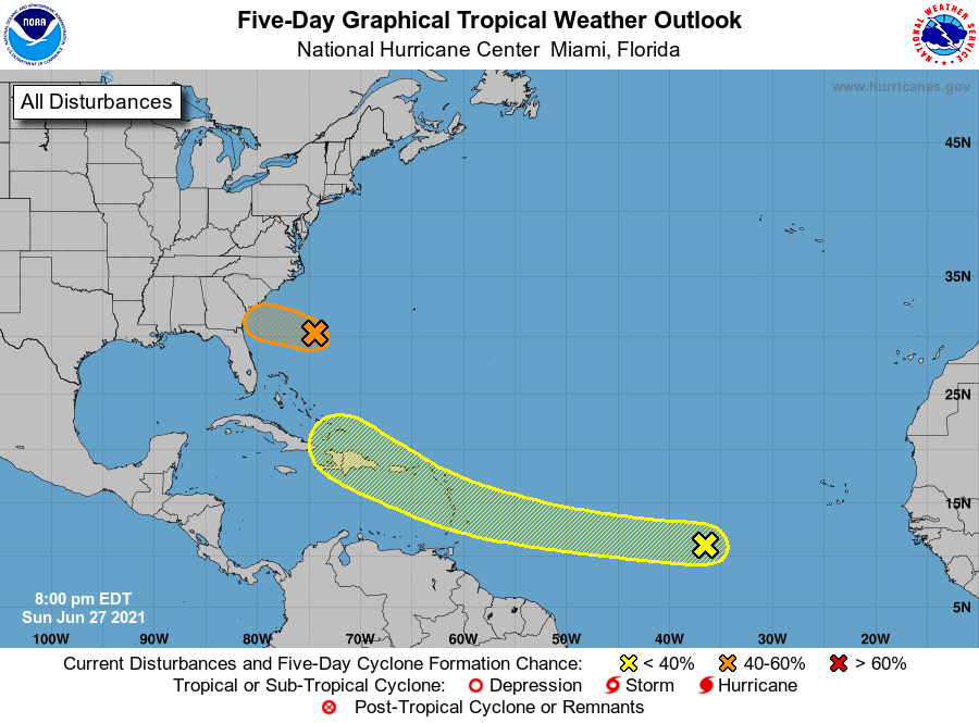
For the North Atlantic...Caribbean Sea and the Gulf of Mexico:
1. A small low pressure system is located about 425 miles
east-southeast of Savannah, Georgia. The associated shower and
thunderstorm activity has become less organized since earlier this
afternoon, becoming displaced to the northwest of the surface center
due to strong upper-level winds. The low is forecast to move
quickly west-northwestward at 15 to 20 mph, crossing over the
warmer waters of the Gulf Stream Monday morning, and it has some
potential to become a tropical depression or tropical storm before
reaching the coast of Georgia or southern South Carolina by Monday
evening. If the system becomes more organized overnight or on
Monday, then tropical storm warnings could be required for a portion
of the Georgia and South Carolina coasts with short notice.
Regardless of development, a few inches of rain are possible along
the immediate coasts of Georgia and southern South Carolina through
Monday night. An Air Force Reserve Unit reconnaissance aircraft is
scheduled to investigate the system Monday afternoon, if necessary.
* Formation chance through 48 hours...medium...50 percent.
* Formation chance through 5 days...medium...50 percent.
2. An area of low pressure associated with a tropical wave is
producing a small cluster of showers and thunderstorms over the
eastern tropical Atlantic Ocean. Some slow development is possible
through the end of the week while this system moves quickly westward
to west-northwestward at about 20 mph, likely reaching the Lesser
Antilles late Wednesday or Wednesday night.
* Formation chance through 48 hours...low...20 percent.
* Formation chance through 5 days...low...30 percent.
Forecaster Berg/Brown