ZCZC MIATWOAT ALL
TTAA00 KNHC DDHHMM
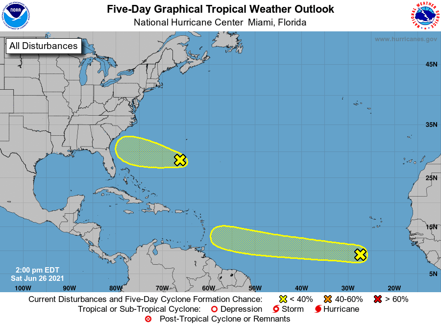
Tropical Weather Outlook
NWS National Hurricane Center Miami FL
200 PM EDT Sat Jun 26 2021
For the North Atlantic...Caribbean Sea and the Gulf of Mexico:
1. A tropical wave associated with a broad area of low pressure is
located over the eastern tropical Atlantic Ocean about 400 miles
south-southwest of the Cabo Verde Islands. Although shower and
thunderstorm activity is currently disorganized, some slow
development will be possible over the next several days while the
disturbance moves generally westward at 15 to 20 mph.
* Formation chance through 48 hours...low...20 percent.
* Formation chance through 5 days...low...30 percent.
2. A surface trough located a couple hundred miles south of Bermuda is
producing a broad area of disorganized showers and thunderstorms.
Although surface pressures are currently high across the area, some
additional slow development could occur while the system moves
westward at 10 to 15 mph over the next few days.
* Formation chance through 48 hours...low...10 percent.
* Formation chance through 5 days...low...10 percent.
Forecaster Papin/Stewart