Skip Navigation Links
NOAA NOAA United States Department of Commerce

NHC Graphical Outlook Archive


« Earliest Available         ‹ Earlier         Later ›         Latest Available »
GIS Shapefiles
Central Pacific Eastern Pacific Atlantic

View 2-Day Graphical Tropical Weather Outlook
Click for Eastern Pacific Click for Eastern Pacific

Tropical Weather Outlook Text

ZCZC MIATWOAT ALL
TTAA00 KNHC DDHHMM

Tropical Weather Outlook
NWS National Hurricane Center Miami FL
800 PM EDT Thu Jun 24 2021

For the North Atlantic...Caribbean Sea and the Gulf of Mexico:

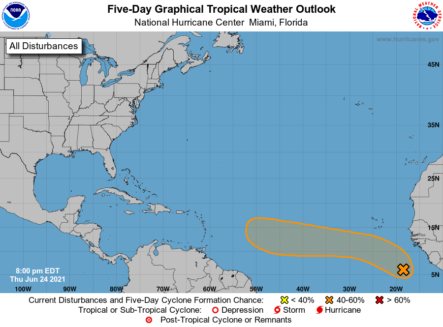
1. A strong tropical wave located over the far eastern Atlantic off 
the African coast is producing a broad area of showers and a few
thunderstorms. As the system moves west-northwestward into the 
central Atlantic Ocean during the next few days, conditions appear 
only marginally conducive for development due to relatively cool 
ocean temperatures. However, some development of this system is 
still possible by early next week.
* Formation chance through 48 hours...low...20 percent.
* Formation chance through 5 days...medium...40 percent.

Forecaster Pasch


List of Atlantic Outlooks (May 2023 - present)
List of East Pacific Outlooks (May 2023 - present)
List of Central Pacific Outlooks (May 2023 - present)
List of Atlantic Outlooks (July 2014 - April 2023)
List of East Pacific Outlooks (July 2014 - April 2023)
List of Central Pacific Outlooks (June 2019 - April 2023)
List of Atlantic Outlooks (June 2009 - June 2014)
List of East Pacific Outlooks (June 2009 - June 2014)