ZCZC MIATWOAT ALL
TTAA00 KNHC DDHHMM
Tropical Weather Outlook
NWS National Hurricane Center Miami FL
800 AM EDT Sun Jun 13 2021
For the North Atlantic...Caribbean Sea and the Gulf of Mexico:
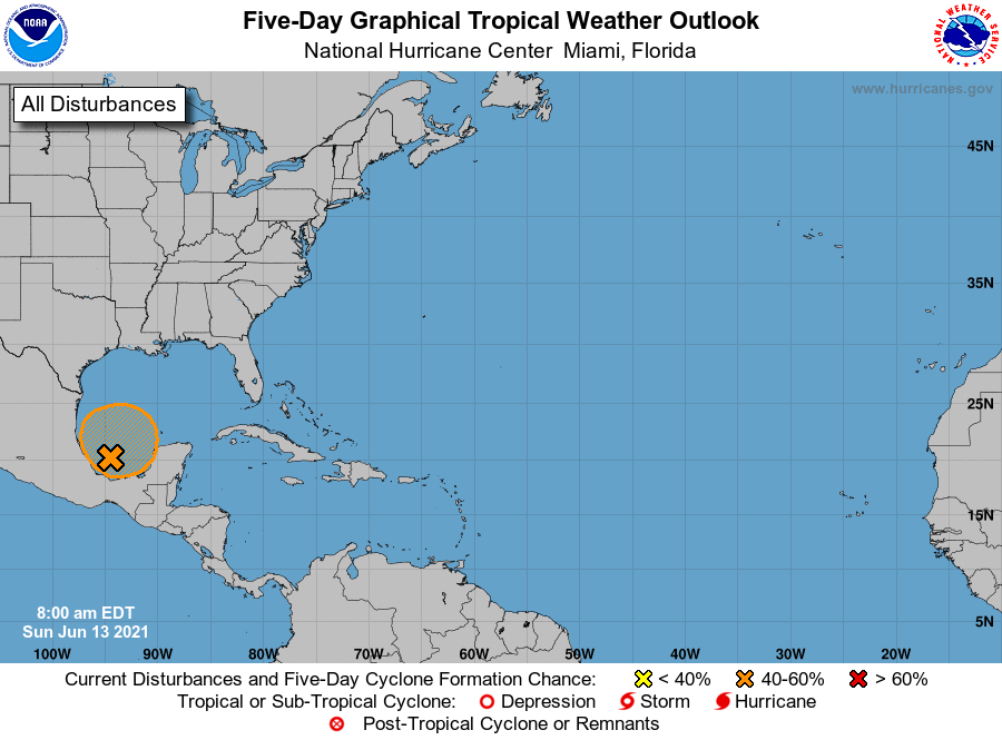
1. A trough of low pressure continues to produce a large area of
disorganized cloudiness and showers over the Bay of Campeche.
Slow development is possible over the next several days while the
broad disturbance moves little, and a tropical depression could form
in this area late in the week. Regardless of development, heavy
rainfall will be possible over portions of Central America and
southern Mexico during the next several days. Please consult
products from your local meteorological service for more
information.
* Formation chance through 48 hours...low...10 percent.
* Formation chance through 5 days...medium...50 percent.
Forecaster Blake