ZCZC MIATWOAT ALL
TTAA00 KNHC DDHHMM
Tropical Weather Outlook
NWS National Hurricane Center Miami FL
200 PM EDT Wed May 19 2021
For the North Atlantic...Caribbean Sea and the Gulf of Mexico:
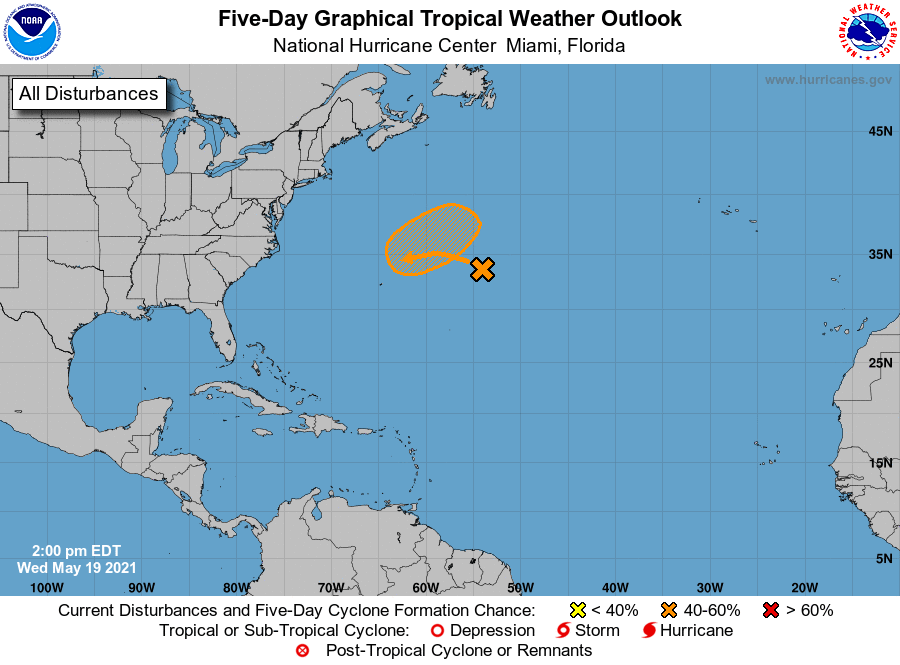
1. A non-tropical low pressure system is forecast to develop a few
hundred miles northeast of Bermuda by tomorrow afternoon and
produce gale-force winds. The low is then forecast to move
west-southwestward over warmer waters on Friday and could become a
short-lived subtropical cyclone over the weekend to the northeast
of Bermuda. The system is expected to move toward the north and
northeast into a more hostile environment by Monday. For more
information on this system, please see High Seas forecasts issued
by the Ocean Prediction Center.
* Formation chance through 48 hours...low...10 percent.
* Formation chance through 5 days...medium...40 percent.
High Seas Forecasts for this system can be found under AWIPS header
NFDHSFAT1, WMO header FZNT01 KWBC, and online at
ocean.weather.gov/shtml/NFDHSFAT1.php
Forecaster Blake