ZCZC MIATWOAT ALL
TTAA00 KNHC DDHHMM
Tropical Weather Outlook
NWS National Hurricane Center Miami FL
700 AM EST Sun Nov 29 2020
For the North Atlantic...Caribbean Sea and the Gulf of Mexico:
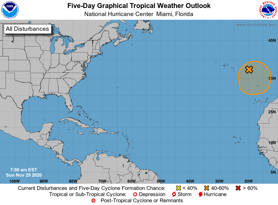
1. A strong and large non-tropical low pressure system over the far
eastern Atlantic is expected to continue moving southward during the
next day or so. The associated shower and thunderstorm activity has
become a little better organized this morning, and the low could
acquire subtropical characteristics in a couple of days while it
meanders just to the north of the Canary Islands. By the middle of
the week, environmental conditions are forecast to become
unfavorable for further development. Regardless of development,
this system could cause strong winds and locally heavy rains in the
Madeira Islands later today through Monday. Additional information
on this system can be found in High Seas Forecasts issued by Meteo
France.
* Formation chance through 48 hours...low...30 percent.
* Formation chance through 5 days...medium...40 percent.
High Seas Forecasts issued by Meteo France can be found under WMO
header FQNT50 LFPW.
Forecaster Beven