Skip Navigation Links
NOAA NOAA United States Department of Commerce

NHC Graphical Outlook Archive


« Earliest Available         ‹ Earlier         Later ›         Latest Available »
GIS Shapefiles
Central Pacific Eastern Pacific Atlantic

View 2-Day Graphical Tropical Weather Outlook
Click for Eastern Pacific Click for Eastern Pacific

Tropical Weather Outlook Text

ZCZC MIATWOAT ALL
TTAA00 KNHC DDHHMM

Tropical Weather Outlook
NWS National Hurricane Center Miami FL
700 AM EST Tue Nov 24 2020

For the North Atlantic...Caribbean Sea and the Gulf of Mexico:

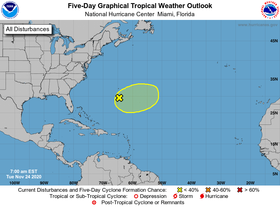
1. A broad area of low pressure located a couple of hundred miles south 
of Bermuda is producing showers and thunderstorms to the east of its 
center as it merges with a frontal system. By late Wednesday or 
Thursday, the system could become separated from the front, allowing 
it to possibly develop some subtropical characteristics later this 
week while it meanders over the central Atlantic.
* Formation chance through 48 hours...low...10 percent.
* Formation chance through 5 days...low...30 percent.

Forecaster Reinhart/Beven


List of Atlantic Outlooks (May 2023 - present)
List of East Pacific Outlooks (May 2023 - present)
List of Central Pacific Outlooks (May 2023 - present)
List of Atlantic Outlooks (July 2014 - April 2023)
List of East Pacific Outlooks (July 2014 - April 2023)
List of Central Pacific Outlooks (June 2019 - April 2023)
List of Atlantic Outlooks (June 2009 - June 2014)
List of East Pacific Outlooks (June 2009 - June 2014)