ZCZC MIATWOAT ALL
TTAA00 KNHC DDHHMM
Tropical Weather Outlook
NWS National Hurricane Center Miami FL
700 AM EST Mon Nov 23 2020
For the North Atlantic...Caribbean Sea and the Gulf of Mexico:
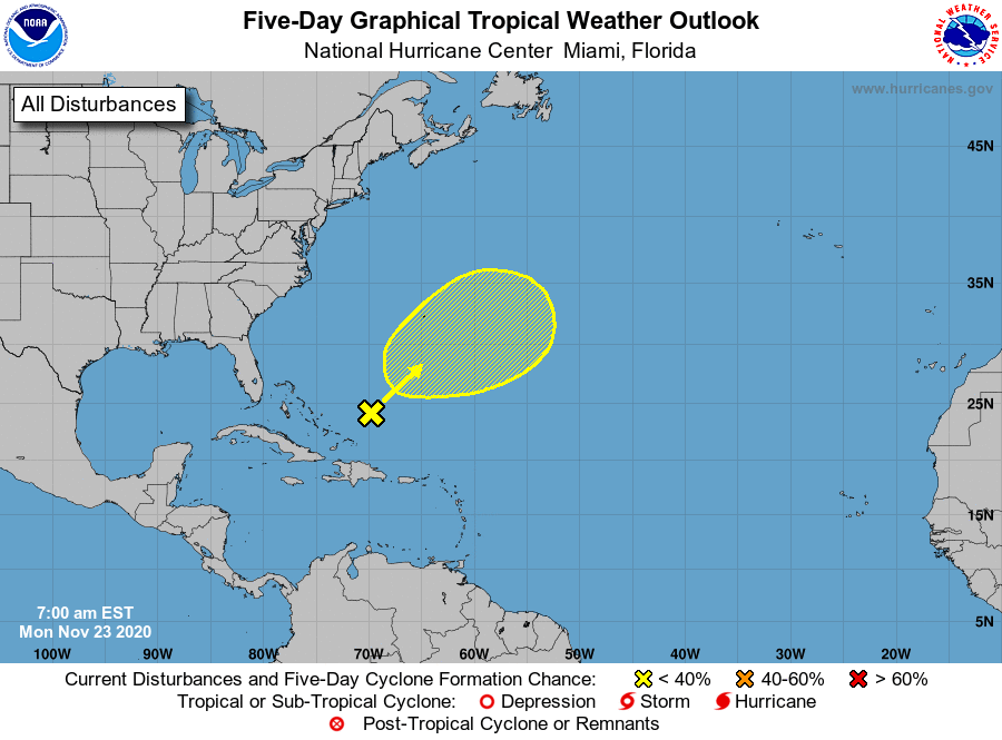
1. A broad area of low pressure located a couple of hundred miles
northeast of the southeast Bahamas is producing disorganized
cloudiness and showers well to the northeast and east of its
center. Strong upper-level winds are expected to limit
development of the system today before the low merges with a cold
front on Tuesday. Later in the week, this system may have another
opportunity to develop subtropical characteristics if it becomes
separated from the front and meanders over the central Atlantic.
* Formation chance through 48 hours...low...10 percent.
* Formation chance through 5 days...low...20 percent.
Forecaster Brown