ZCZC MIATWOAT ALL
TTAA00 KNHC DDHHMM
Tropical Weather Outlook
NWS National Hurricane Center Miami FL
700 AM EST Fri Nov 13 2020
For the North Atlantic...Caribbean Sea and the Gulf of Mexico:
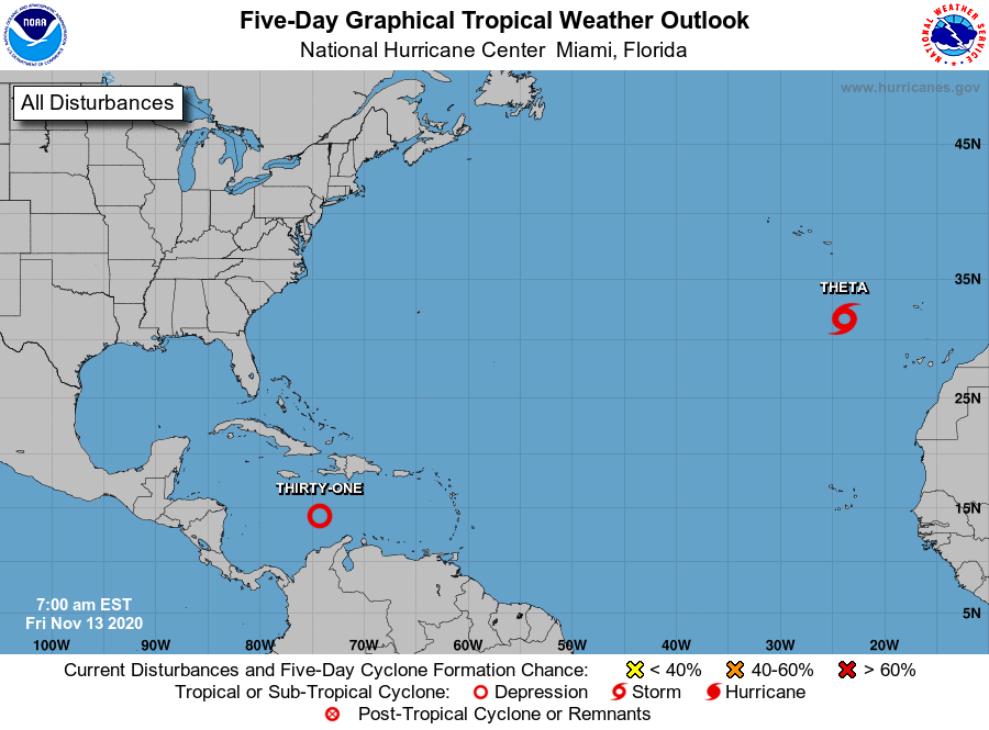
The National Hurricane Center has issued the last advisory on Eta
which has become a post-tropical cyclone off the coast of North
Carolina. The National Hurricane Center is issuing advisories on
Tropical Storm Theta, located over the eastern Atlantic.
1. Showers and thunderstorms associated with a broad area of low
pressure over the central Caribbean Sea have increased and become
better organized since yesterday. Environmental conditions are
conducive for additional development, and a tropical depression or
tropical storm is likely to form later today or tonight while the
system moves slowly westward. Additional development of the
system is likely over the weekend, and interests in Honduras and
Nicaragua should closely monitor the progress of the disturbance.
* Formation chance through 48 hours...high...90 percent.
* Formation chance through 5 days...high...90 percent.
Forecaster Brown