ZCZC MIATWOAT ALL
TTAA00 KNHC DDHHMM
Tropical Weather Outlook
NWS National Hurricane Center Miami FL
100 AM EST Fri Nov 13 2020
For the North Atlantic...Caribbean Sea and the Gulf of Mexico:
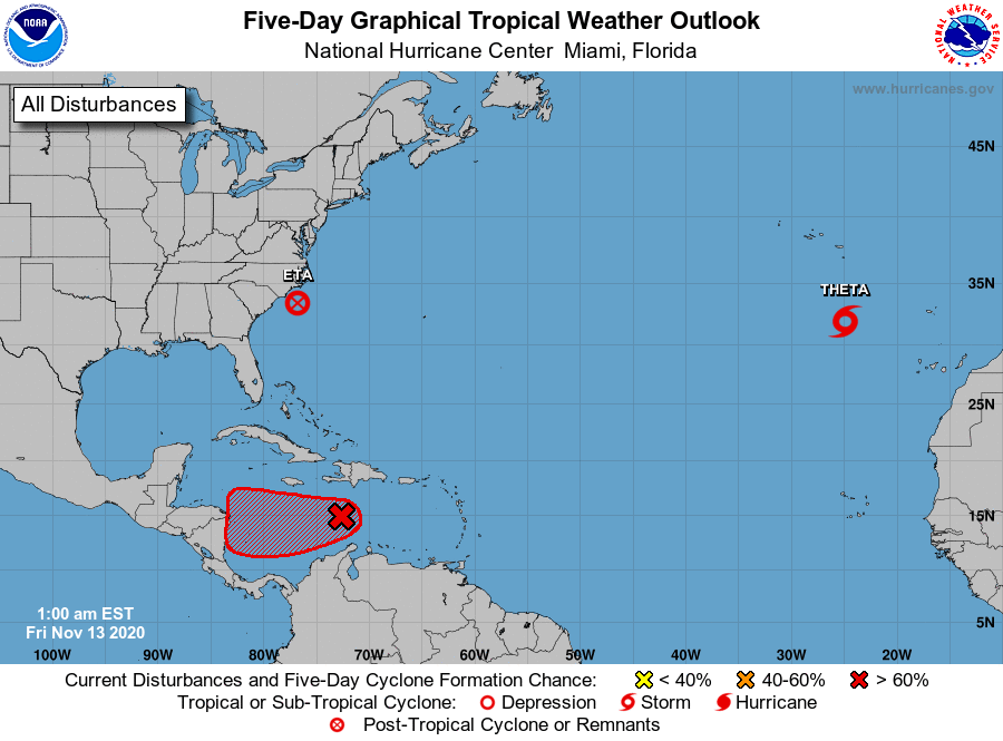
The National Hurricane Center is issuing advisories on Tropical
Storm Eta, located near the coast of the southeast U.S., and on
Tropical Storm Theta, located over the eastern Atlantic.
1. A tropical wave located over the central Caribbean Sea continues to
produce a large area of showers and thunderstorms. This system has
become a little better organized during the past several hours.
Additional development is expected, and a tropical depression will
likely form within the next day or two as it moves slowly westward
over the central and western Caribbean Sea. Interests in Honduras
and Nicaragua should closely monitor the progress of this system.
Regardless of development, this disturbance is expected to bring
heavy rainfall along with possible flash flooding to portions of
Hispaniola over the next day or so. For more detailed information,
refer to products issued by your local weather office.
* Formation chance through 48 hours...high...90 percent.
* Formation chance through 5 days...high...90 percent.
Forecaster Beven