ZCZC MIATWOAT ALL
TTAA00 KNHC DDHHMM
Tropical Weather Outlook
NWS National Hurricane Center Miami FL
200 PM EDT Fri Oct 30 2020
For the North Atlantic...Caribbean Sea and the Gulf of Mexico:
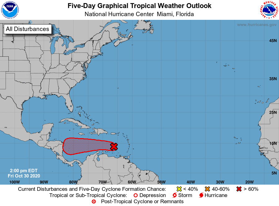
1. A tropical wave located over the eastern Caribbean Sea is producing
a concentrated area of showers and thunderstorms. This system is
gradually becoming better organized, and conditions appear
conducive for further development. A tropical depression is
likely to form this weekend or early next week as the system moves
westward across the central and western Caribbean Sea. Regardless
of development, this system is expected to produce heavy rainfall
across portions of the ABC islands and Jamaica through the weekend.
* Formation chance through 48 hours...high...70 percent.
* Formation chance through 5 days...high...80 percent.
Forecaster Papin/Berg