ZCZC MIATWOAT ALL
TTAA00 KNHC DDHHMM
Tropical Weather Outlook
NWS National Hurricane Center Miami FL
800 PM EDT Wed Oct 21 2020
For the North Atlantic...Caribbean Sea and the Gulf of Mexico:
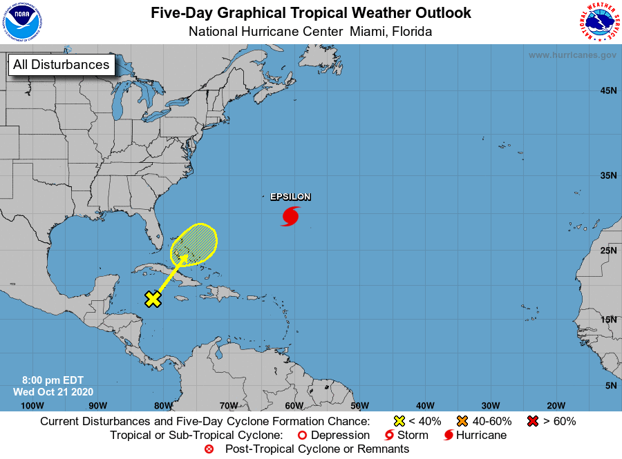
The National Hurricane Center is issuing advisories on Hurricane
Epsilon, located over the central Atlantic a few hundred miles
east-southeast of Bermuda.
1. A trough of low pressure located over the western Caribbean Sea
is producing a large area of disorganized showers and thunderstorms.
Development of this system is unlikely to occur during the next few
days as it passes near western or central Cuba, and moves over the
Straits of Florida. By late weekend or early next week, however,
some slow development of this system is possible while it moves
generally northeastward near the central Bahamas. Regardless of
development, locally heavy rainfall is possible over portions of
Cuba, South Florida, and the Bahamas through early next week.
* Formation chance through 48 hours...low...near 0 percent.
* Formation chance through 5 days...low...20 percent.
Forecaster Roberts