ZCZC MIATWOAT ALL
TTAA00 KNHC DDHHMM
Tropical Weather Outlook
NWS National Hurricane Center Miami FL
200 PM EDT Thu Oct 15 2020
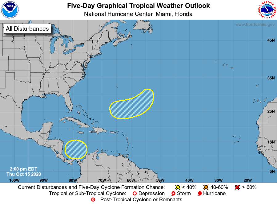
For the North Atlantic...Caribbean Sea and the Gulf of Mexico:
1. A broad non-tropical low pressure system is expected to form over
the next couple of days several hundred miles east-southeast of
Bermuda. Additional slow development will be possible thereafter
into early next week while the system moves southwestward and then
westward, passing about between Bermuda and the northern Lesser
Antilles.
* Formation chance through 48 hours...low...near 0 percent.
* Formation chance through 5 days...low...20 percent.
2. A broad area of low pressure could form by early next week over
the southwestern Caribbean Sea. Some gradual development of the
system will be possible thereafter while it moves slowly
northwestward.
* Formation chance through 48 hours...low...near 0 percent.
* Formation chance through 5 days...low...20 percent.
Forecaster Beven