Skip Navigation Links
NOAA NOAA United States Department of Commerce

NHC Graphical Outlook Archive


« Earliest Available         ‹ Earlier         Later ›         Latest Available »
GIS Shapefiles
Central Pacific Eastern Pacific Atlantic

View 2-Day Graphical Tropical Weather Outlook
Click for Eastern Pacific Click for Eastern Pacific

Tropical Weather Outlook Text

ZCZC MIATWOAT ALL
TTAA00 KNHC DDHHMM

Tropical Weather Outlook
NWS National Hurricane Center Miami FL
800 AM EDT Mon Oct 12 2020

For the North Atlantic...Caribbean Sea and the Gulf of Mexico:

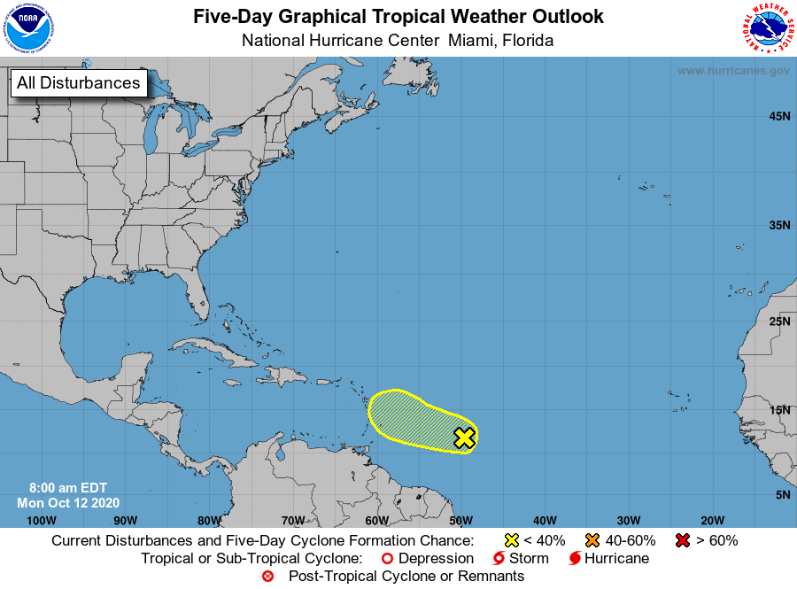
1. Showers and thunderstorms associated with a tropical wave located 
about 750 miles east of the Windward Islands continue to show signs 
of organization.  Slow development of this system is possible 
during the next day or so while it moves generally westward near 15 
mph. Strong upper-level winds are expected to limit further 
development by midweek.
* Formation chance through 48 hours...low...30 percent.
* Formation chance through 5 days...low...30 percent.

Forecaster Beven


List of Atlantic Outlooks (May 2023 - present)
List of East Pacific Outlooks (May 2023 - present)
List of Central Pacific Outlooks (May 2023 - present)
List of Atlantic Outlooks (July 2014 - April 2023)
List of East Pacific Outlooks (July 2014 - April 2023)
List of Central Pacific Outlooks (June 2019 - April 2023)
List of Atlantic Outlooks (June 2009 - June 2014)
List of East Pacific Outlooks (June 2009 - June 2014)