ZCZC MIATWOAT ALL
TTAA00 KNHC DDHHMM
Tropical Weather Outlook
NWS National Hurricane Center Miami FL
800 AM EDT Thu Aug 27 2020
For the North Atlantic...Caribbean Sea and the Gulf of Mexico:
The National Hurricane Center is issuing advisories on powerful
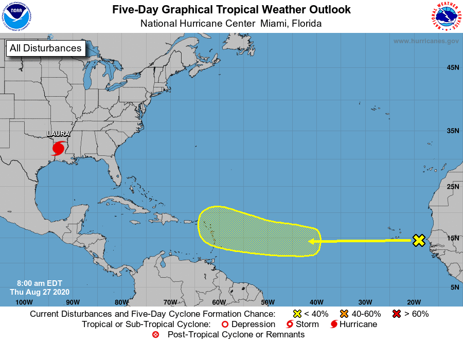
Hurricane Laura, located inland over western Louisiana.
1. A westward-moving tropical wave located over the far eastern
tropical Atlantic, a couple of hundred miles east of the Cabo Verde
Islands, continues to produce disorganized shower activity.
Although environmental conditions are not expected to be conducive
for development during the next couple of days, they are forecast
to gradually become more favorable over the weekend and into early
next week when the wave moves into the central tropical Atlantic.
* Formation chance through 48 hours...low...near 0 percent.
* Formation chance through 5 days...low...20 percent.
Forecaster Latto