ZCZC MIATWOAT ALL
TTAA00 KNHC DDHHMM
Tropical Weather Outlook
NWS National Hurricane Center Miami FL
800 PM EDT Fri Aug 21 2020
For the North Atlantic...Caribbean Sea and the Gulf of Mexico:
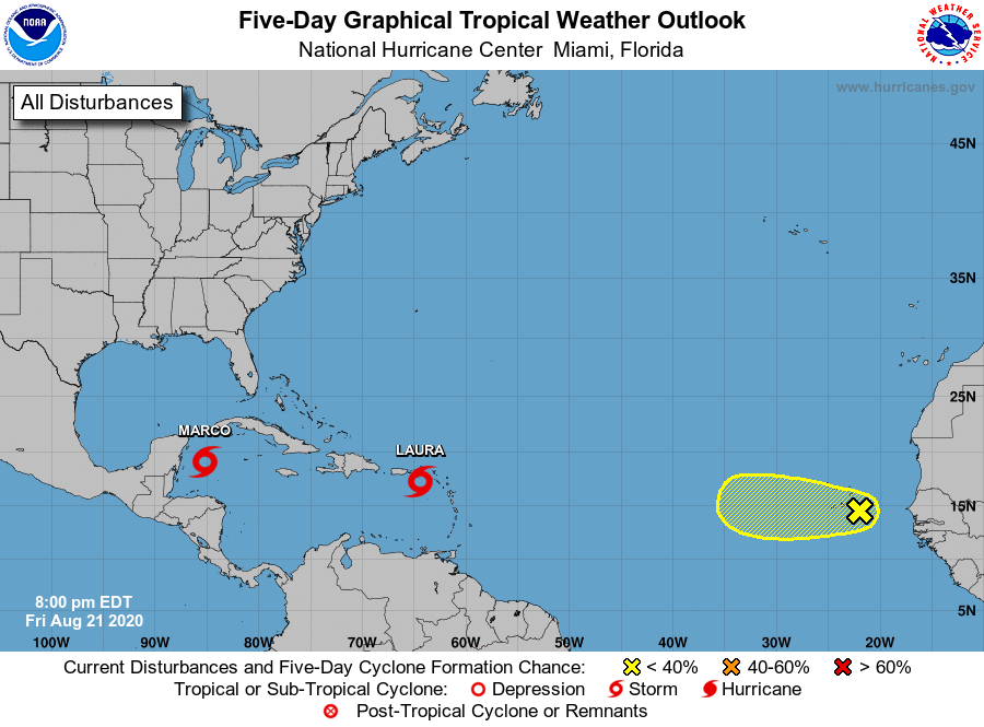
The National Hurricane Center is issuing advisories on Tropical
Storm Laura, located near the northern Leeward Islands, and on
Tropical Depression Fourteen, located over the northwestern
Caribbean Sea.
1. Disorganized showers and thunderstorms located between the west
coast of Africa and the Cabo Verde Islands are associated with
a broad area of low pressure and tropical wave. This disturbance is
expected to move westward across the Cabo Verde Islands on Saturday
and it will likely produce gusty winds and locally heavy rainfall
there. Some slow development of this wave is possible during the
next couple of days while it moves across the eastern
tropical Atlantic before environmental conditions become less
favorable for development.
* Formation chance through 48 hours...low...20 percent.
* Formation chance through 5 days...low...20 percent.
Forecaster Cangialosi