ZCZC MIATWOAT ALL
TTAA00 KNHC DDHHMM
Tropical Weather Outlook
NWS National Hurricane Center Miami FL
800 PM EDT Sat Aug 15 2020
For the North Atlantic...Caribbean Sea and the Gulf of Mexico:
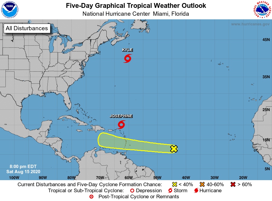
The National Hurricane Center is issuing advisories on Tropical
Storm Josephine, located over the tropical Atlantic Ocean a few
hundred miles northeast of the northern Leeward Islands, and on
Tropical Storm Kyle, located several hundred miles southeast of
the New England states of the United States.
1. A westward-moving tropical wave located over the central tropical
Atlantic several hundred miles east of the Windward Islands is
currently producing limited shower and thunderstorm activity.
However, upper-level winds are expected to become a little more
conducive for development by the middle of next week as the
disturbance approaches the central and southern Lesser Antilles
and moves into the eastern Caribbean Sea.
* Formation chance through 48 hours...low...10 percent.
* Formation chance through 5 days...low...20 percent.
Forecaster Stewart