ZCZC MIATWOAT ALL
TTAA00 KNHC DDHHMM
Tropical Weather Outlook
NWS National Hurricane Center Miami FL
800 AM EDT Fri Aug 14 2020
For the North Atlantic...Caribbean Sea and the Gulf of Mexico:
The National Hurricane Center is issuing advisories on Tropical
Storm Josephine, located over the tropical Atlantic Ocean several
hundred miles east-southeast of the northern Leeward Islands.
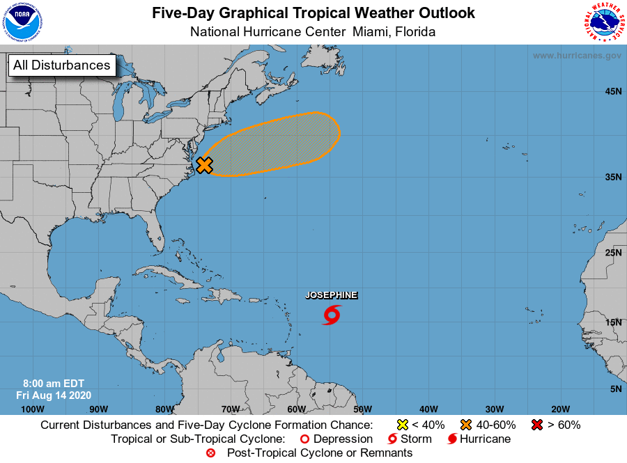
1. Shower activity has increased in association with a low pressure
area located about 100 miles northeast of Cape Hatteras, North
Carolina. Some additional development is possible during the next
couple of days, and a tropical or subtropical depression could form
during that time as the system moves east-northeastward well
to the southeast of New England and to the south of the Canadian
Maritime provinces.
* Formation chance through 48 hours...medium...40 percent.
* Formation chance through 5 days...medium...50 percent.
Forecaster Beven