ZCZC MIATWOAT ALL
TTAA00 KNHC DDHHMM
Tropical Weather Outlook
NWS National Hurricane Center Miami FL
200 PM EDT Mon Aug 10 2020
For the North Atlantic...Caribbean Sea and the Gulf of Mexico:
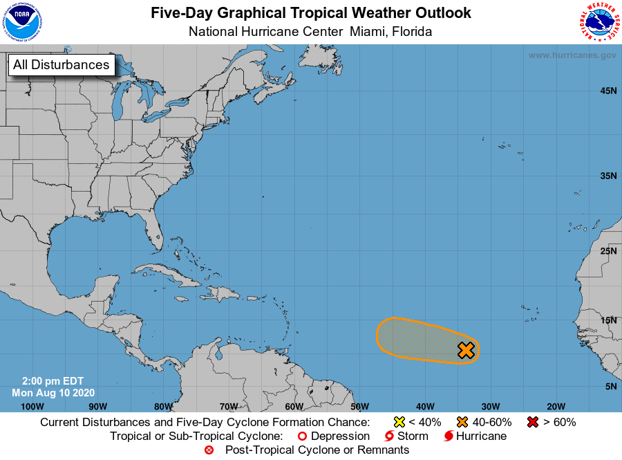
1. A broad area of low pressure located almost 700 miles west-southwest
of the Cabo Verde Islands is not currently showing signs of
additional organization, with satellite-derived wind data from this
morning still showing the system having an elongated surface
circulation. However, environmental conditions are expected to be
somewhat conducive for development to occur, and a tropical
depression could form during the next couple of days while the
disturbance moves generally westward to west-northwestward at 10 to
15 mph across the tropical Atlantic. Conditions are forecast to
become less conducive for development by the end of the week.
* Formation chance through 48 hours...medium...60 percent.
* Formation chance through 5 days...medium...60 percent.
Forecaster Berg