ZCZC MIATWOAT ALL
TTAA00 KNHC DDHHMM
Tropical Weather Outlook
NWS National Hurricane Center Miami FL
200 AM EDT Sat Aug 1 2020
For the North Atlantic...Caribbean Sea and the Gulf of Mexico:
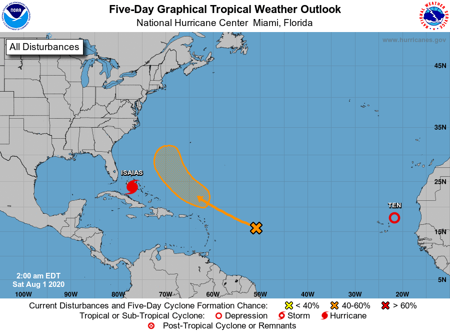
The National Hurricane Center is issuing advisories on Hurricane
Isaias, located near the central Bahamas, and on Tropical
Depression Ten, located over the far eastern Atlantic between Africa
and the Cabo Verde Islands.
1. A westward-moving tropical wave located about 650 miles east of
the Lesser Antilles continues to produce a few disorganized
showers. Environmental conditions are forecast to become more
conducive for development in a day or two, and a tropical
depression could form early next week. This system is forecast to
turn northwestward, and then northward over the western Atlantic
north of the Leeward Islands through the middle of next week.
* Formation chance through 48 hours...low...near 0 percent.
* Formation chance through 5 days...medium...50 percent.
Public Advisories on Tropical Depression Ten are issued under WMO
header WTNT35 KNHC and under AWIPS header MIATCPAT5.
Forecast/Advisories on Tropical Depression Ten are issued under WMO
header WTNT25 KNHC and under AWIPS header MIATCMAT5.
Forecaster Blake