ZCZC MIATWOAT ALL
TTAA00 KNHC DDHHMM
Tropical Weather Outlook
NWS National Hurricane Center Miami FL
800 AM EDT Fri Jul 31 2020
For the North Atlantic...Caribbean Sea and the Gulf of Mexico:
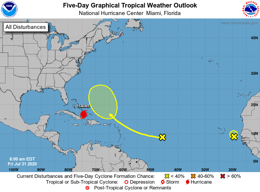
The National Hurricane Center is issuing advisories on Hurricane
Isaias, located near the southeastern Bahamas.
1. Showers and thunderstorms associated with a small area of low
pressure located a couple of hundred miles east-southeast of the
Cabo Verde Islands have become less organized since yesterday. The
system is moving northward toward less favorable environmental
conditions, and the chance of this system becoming a tropical
depression is decreasing.
* Formation chance through 48 hours...low...20 percent.
* Formation chance through 5 days...low...20 percent.
2. A westward-moving tropical wave located about 1000 miles east of the
Lesser Antilles is producing a limited amount of shower activity.
Some slow development of this system is possible while it turns
northwestward over the western Atlantic by early next week.
* Formation chance through 48 hours...low...near 0 percent.
* Formation chance through 5 days...low...20 percent.
Forecaster Brown