ZCZC MIATWOAT ALL
TTAA00 KNHC DDHHMM
Tropical Weather Outlook
NWS National Hurricane Center Miami FL
200 PM EDT Sat Jul 25 2020
For the North Atlantic...Caribbean Sea and the Gulf of Mexico:
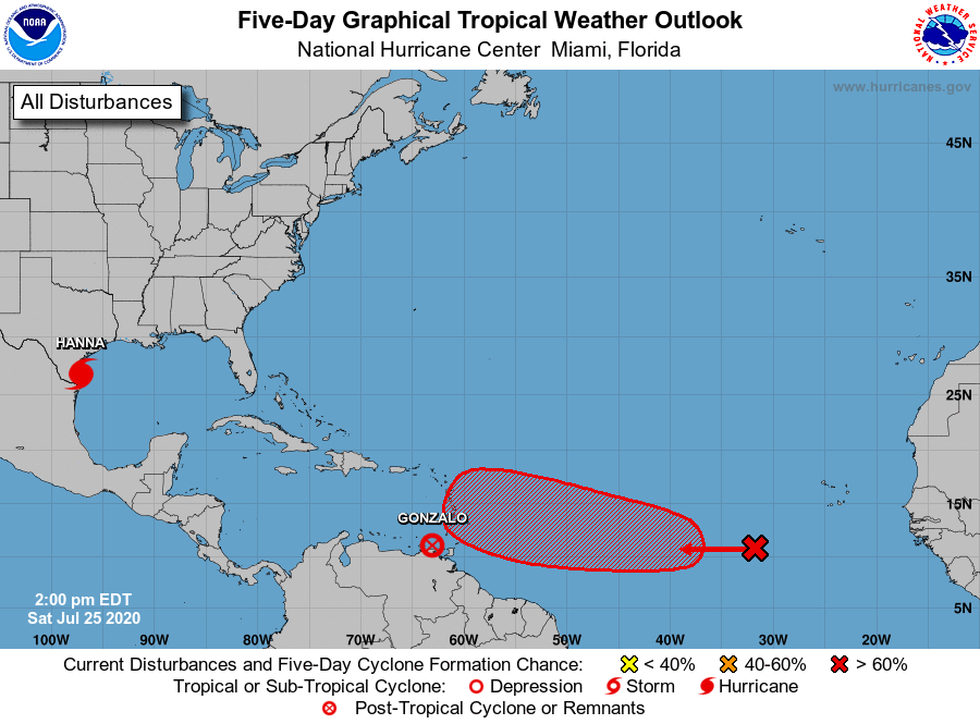
The National Hurricane Center is issuing advisories on Tropical
Depression Gonzalo, located just of northwest of Trinidad.
The National Hurricane Center is also issuing advisories on
Hurricane Hanna, located over the western Gulf of Mexico just
offshore the southern coast of Texas.
1. A tropical wave is producing a broad area of cloudiness and
disorganized showers and thunderstorms several hundred miles
southwest of Cabo Verde Islands. The wave is expected to move
westward at about 15 mph during the next several days, and a
tropical depression is likely form early next week when the system
reaches the central tropical Atlantic.
* Formation chance through 48 hours...low...20 percent.
* Formation chance through 5 days...high...70 percent.
Forecaster Stewart