ZCZC MIATWOAT ALL
TTAA00 KNHC DDHHMM
Tropical Weather Outlook
NWS National Hurricane Center Miami FL
800 PM EDT Tue Jul 21 2020
For the North Atlantic...Caribbean Sea and the Gulf of Mexico:
The National Hurricane Center is issuing advisories on newly formed
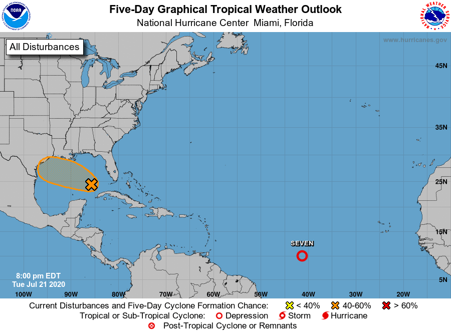
Tropical Depression Seven, located over the central tropical
Atlantic.
1. A tropical wave is producing a large area of disorganized showers
and thunderstorms over the eastern Gulf of Mexico, southern
Florida, and western Cuba. Gradual development of this
system is possible while it moves west-northwestward during the
next few days. This system is expected to move over the central
Gulf on Wednesday, and reach the northwestern Gulf on Thursday and
Friday. An Air Force Reserve Hurricane Hunter aircraft is
scheduled to investigate the system on Wednesday, if necessary.
* Formation chance through 48 hours...low...30 percent.
* Formation chance through 5 days...medium...40 percent.
Public Advisories on Tropical Depression Seven are issued under WMO
header WTNT32 KNHC and under AWIPS header MIATCPAT2.
Forecast/Advisories on Tropical Depression Seven are issued under
WMO header WTNT22 KNHC and under AWIPS header MIATCMAT2.
Forecaster Cangialosi