ZCZC MIATWOAT ALL
TTAA00 KNHC DDHHMM
Tropical Weather Outlook
NWS National Hurricane Center Miami FL
Issued by the NWS Weather Prediction Center College Park MD
200 PM EDT Tue Jul 7 2020
For the North Atlantic...Caribbean Sea and the Gulf of Mexico:
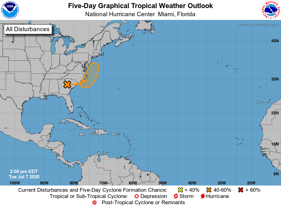
1. An area of low pressure located inland over northeastern Georgia
continues to produce a large area of showers and heavy rain over
portions of the southeastern U.S. The low is expected to move
generally northeastward toward the coast of the Carolinas and the
mid-Atlantic states and some development of this system is possible
later this week if it moves over water. Regardless of development,
the low is forecast to produce locally heavy rainfall that could
cause flash flooding across portions of the southeastern U.S. during
the next couple of days.
* Formation chance through 48 hours...low...30 percent.
* Formation chance through 5 days...medium...40 percent.
Forecaster Zelinsky