ZCZC MIATWOAT ALL
TTAA00 KNHC DDHHMM
Tropical Weather Outlook
NWS National Hurricane Center Miami FL
800 AM EDT Sun Jul 5 2020
For the North Atlantic...Caribbean Sea and the Gulf of Mexico:
The National Hurricane Center is issuing advisories on Tropical
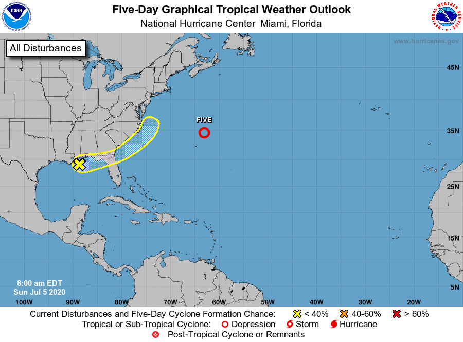
Depression Five, located just north of Bermuda.
1. A broad area of low pressure located along the northern Gulf Coast
is producing disorganized showers and a few thunderstorms. Some
slight development of this system is possible before the disturbance
moves onshore along the northeastern Gulf Coast on Monday. The
system is then forecast to move northeastward and could emerge
offshore of the Carolinas later this week, where environmental
conditions are expected to be more conducive for development.
* Formation chance through 48 hours...low...10 percent.
* Formation chance through 5 days...low...30 percent.
Public Advisories on Tropical Depression Five are issued under WMO
header WTNT35 KNHC and under AWIPS header MIATCPAT5.
Forecast/Advisories on Tropical Depression Five are issued under
WMO header WTNT25 KNHC and under AWIPS header MIATCMAT5.
Forecaster Zelinsky