ZCZC MIATWOAT ALL
TTAA00 KNHC DDHHMM
Tropical Weather Outlook
NWS National Hurricane Center Miami FL
800 PM EDT Sun Jun 28 2020
For the North Atlantic...Caribbean Sea and the Gulf of Mexico:
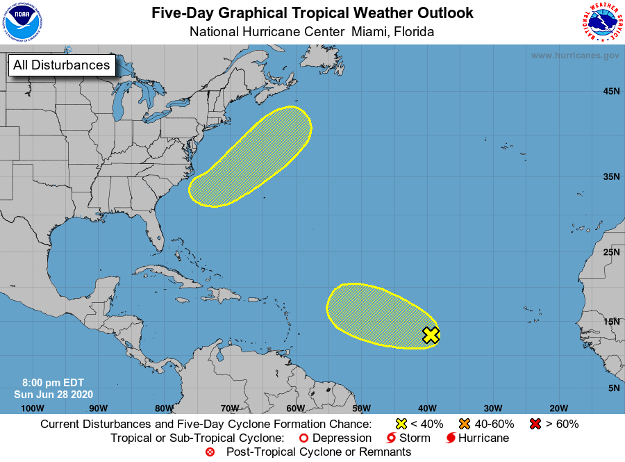
1. A tropical wave located about 1000 miles west-southwest of the Cabo
Verde Islands is moving west-northwestward at about 20 mph. Shower
and thunderstorm activity associated with this system has become
limited, and environmental conditions are expected to remain
unfavorable for significant development of this disturbance.
* Formation chance through 48 hours...low...10 percent.
* Formation chance through 5 days...low...10 percent.
2. An area of low pressure is forecast to form off of the southeastern
coast of the United States on Tuesday. Some development of this
system could then occur as it moves generally northeastward well
offshore of the east coast of the United States. The low is
forecast to reach cooler waters Wednesday night or Thursday, and
development after that time is not anticipated.
* Formation chance through 48 hours...low...near 0 percent.
* Formation chance through 5 days...low...20 percent.
Forecaster Brown