ZCZC MIATWOAT ALL
TTAA00 KNHC DDHHMM
Tropical Weather Outlook
NWS National Hurricane Center Miami FL
200 PM EDT Sun Jun 28 2020
For the North Atlantic...Caribbean Sea and the Gulf of Mexico:
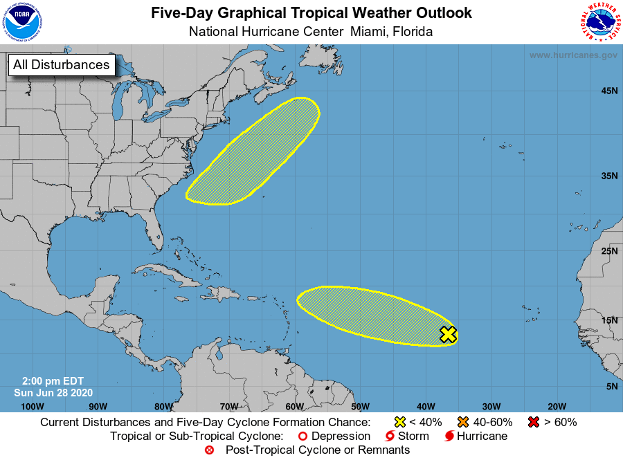
1. A tropical wave located several hundred miles west-southwest of the
Cabo Verde Islands is moving west-northwestward at about 20 mph.
Some slow development of this system is possible during the next 2
to 3 days. After that time, environmental conditions are forecast
to become less conducive for development.
* Formation chance through 48 hours...low...10 percent.
* Formation chance through 5 days...low...20 percent.
2. A low pressure area is expected to form in a couple of days off of
the southeastern coast of the United States. Some additional
development of this system could then occur as it moves generally
northeastward.
* Formation chance through 48 hours...low...near 0 percent.
* Formation chance through 5 days...low...20 percent.
Forecaster Beven