ZCZC MIATWOAT ALL
TTAA00 KNHC DDHHMM
Tropical Weather Outlook
NWS National Hurricane Center Miami FL
200 PM EDT Tue Jun 16 2020
For the North Atlantic...Caribbean Sea and the Gulf of Mexico:
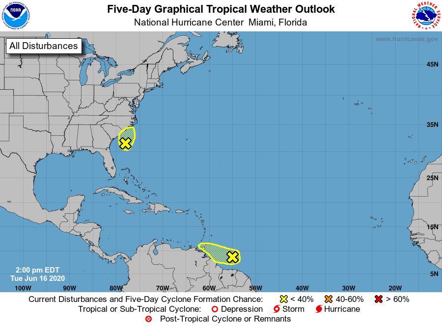
1. A non-tropical low pressure area located about 150 miles
south-southeast of the North Carolina-South Carolina border
continues to produce disorganized showers and thunderstorms over
portions of southeastern and eastern North Carolina, including the
Outer Banks, and adjacent Atlantic waters. The low has moved little
today, but a slow northward motion is forecast to begin by this
evening. Environmental conditions are expected to remain
unfavorable for significant development through tonight when the low
should move inland over eastern North Carolina. Regardless of
development, heavy rainfall could occur over portions of
northeastern South Carolina and southeastern and eastern North
Carolina through Wednesday. For additional information, see products
from your local National Weather Service office.
* Formation chance through 48 hours...low...10 percent.
* Formation chance through 5 days...low...10 percent.
2. Showers and thunderstorms located a few hundred miles east of
Trinidad and Tobago are associated with a westward-moving tropical
wave. Some slow development of this system is possible over the next
couple of days before upper level winds become less conducive and
the system begins to interact with the landmass of South America.
Regardless of development, this system could produce gusty winds and
heavy rainfall over Trinidad and Tobago and the northeastern
coastal sections of Venezuela through the middle of the week.
* Formation chance through 48 hours...low...10 percent.
* Formation chance through 5 days...low...10 percent.
Forecaster Latto