ZCZC MIATWOAT ALL
TTAA00 KNHC DDHHMM
Tropical Weather Outlook
NWS National Hurricane Center Miami FL
100 PM EST Mon Nov 18 2019
For the North Atlantic...Caribbean Sea and the Gulf of Mexico:
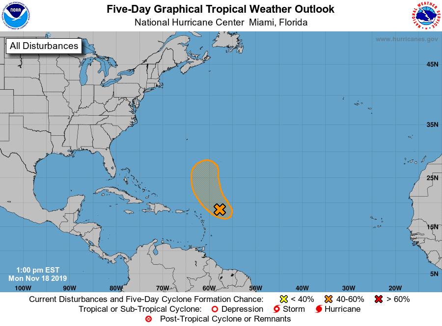
1. A broad area of low pressure located about 250 miles east-northeast
of the northern Leeward Islands is producing disorganized showers
and thunderstorms and winds of 30 to 35 mph on its northeastern
side. Some gradual development of this system is expected, and a
tropical or subtropical depression could form during the next couple
of days while it moves northwestward and then northward over the
open Atlantic. In a couple of days, upper-level winds are expected
to become less conducive and the disturbance is forecast to merge
with a frontal system after midweek, so additional development is
not expected after that time. For more information, see High Seas
Forecasts issued by the National Weather Service.
* Formation chance through 48 hours...medium...50 percent.
* Formation chance through 5 days...medium...50 percent.
High Seas Forecasts issued by the National Weather Service can be
found under AWIPS header NFDHSFAT1, WMO header FZNT01 KWBC, and
online at ocean.weather.gov/shtml/NFDHSFAT1.php
Forecaster Latto