ZCZC MIATWOAT ALL
TTAA00 KNHC DDHHMM
Tropical Weather Outlook
NWS National Hurricane Center Miami FL
700 AM EST Sun Nov 17 2019
For the North Atlantic...Caribbean Sea and the Gulf of Mexico:
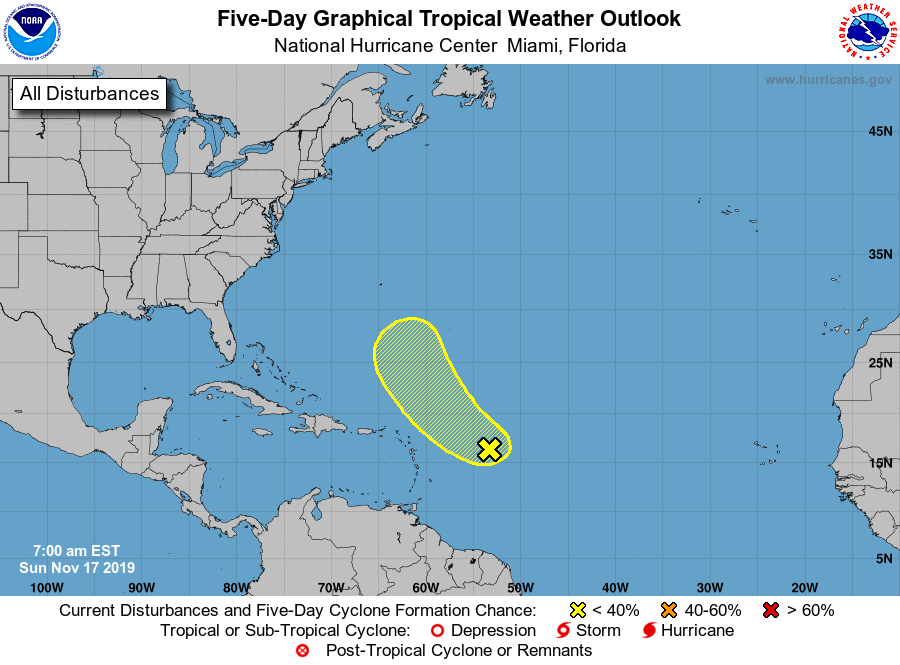
1. A large area of disorganized cloudiness and thunderstorms located
over the central Atlantic Ocean several hundred miles east of the
northern Leeward Islands is associated with an upper-level low and
surface trough. Some slow development of this system is possible
during the next few days while it moves northwestward and then
northward over the open Atlantic. The disturbance is forecast to
merge with a frontal system after midweek and further development
is not expected after that time.
* Formation chance through 48 hours...low...20 percent.
* Formation chance through 5 days...low...30 percent.
Forecaster Latto