ZCZC MIATWOAT ALL
TTAA00 KNHC DDHHMM
Tropical Weather Outlook
NWS National Hurricane Center Miami FL
800 AM EDT Thu Oct 31 2019
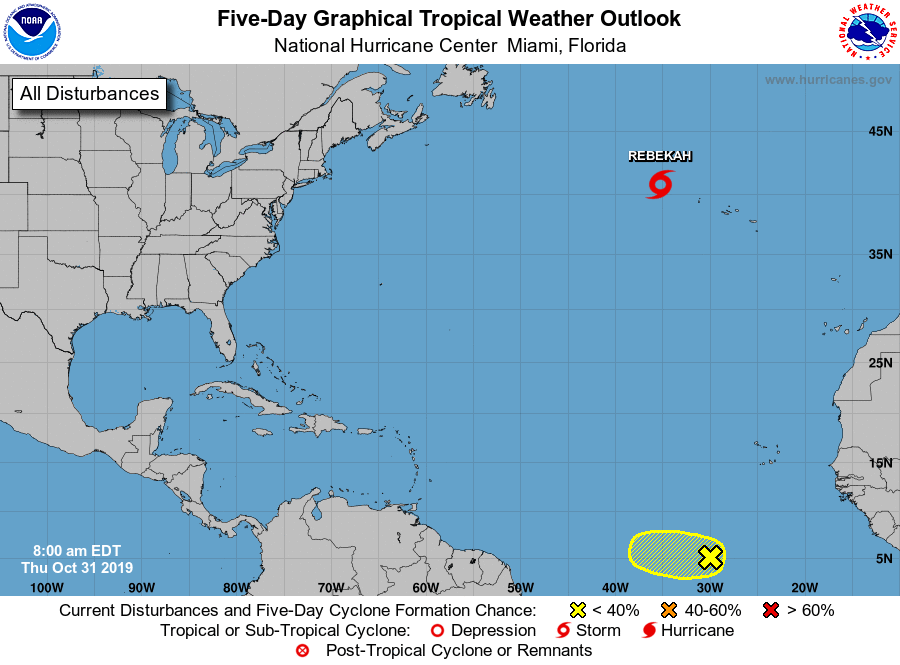
For the North Atlantic...Caribbean Sea and the Gulf of Mexico:
The National Hurricane Center is issuing advisories on Subtropical
Storm Rebekah located over the north Atlantic, several hundred
miles west of the Azores.
1. A broad area of disturbed weather has developed nearly 1000 miles
south-southwest of the Cabo Verde Islands. Some slow development of
this system is possible during the next day or two while it moves
generally westward across the central Atlantic. Upper-level winds
are forecast to become unfavorable for further development by the
weekend.
* Formation chance through 48 hours...low...10 percent.
* Formation chance through 5 days...low...10 percent.
Public Advisories on Subtropical Storm Rebekah are issued under
WMO header WTNT34 KNHC and under AWIPS header MIATCPAT4.
Forecast/Advisories are issued under WMO header WTNT24 KNHC and
under AWIPS header MIATCMAT4.
Forecaster Zelinsky