ZCZC MIATWOAT ALL
TTAA00 KNHC DDHHMM
Special Tropical Weather Outlook
NWS National Hurricane Center Miami FL
945 AM EDT Fri Oct 25 2019
For the North Atlantic...Caribbean Sea and the Gulf of Mexico:
Special outlook issued to update discussion of systems in the Gulf
of Mexico and southwest of the Azores.
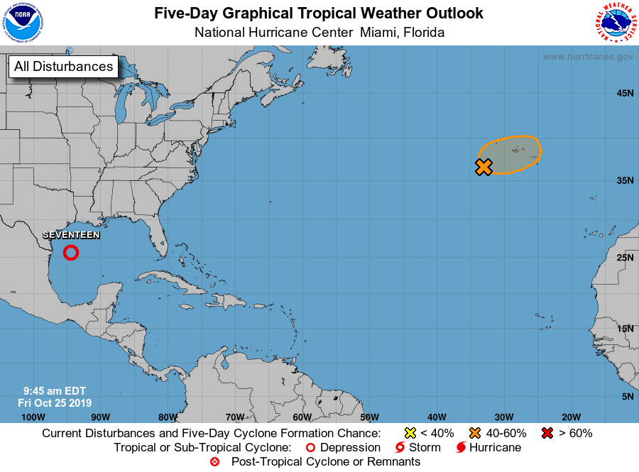
1. Updated: Visible satellite imagery and surface observations indicate
that a tropical cyclone is forming in the western Gulf of Mexico,
and advisories will be initiated on this system later this morning.
The system is forecast to merge with a cold front and become post-
tropical tonight over the northwestern Gulf of Mexico. Gale-force
winds are expected behind the cold front over the western Gulf of
Mexico today and Saturday. For more information, see High Seas
Forecasts issued by the National Weather Service. An Air Force
Reserve Hurricane Hunter aircraft is scheduled to investigate the
system later today.
* Formation chance through 48 hours...high...near 100 percent.
* Formation chance through 5 days...high...near 100 percent.
2. Updated: Recent satellite derived winds indicate that the small
non-tropical low centered a few hundred miles southwest of the
western Azores is producing tropical-storm-force winds near the
center. The thunderstorm activity is becoming better organized and
if this trend continues a tropical or subtropical cyclone could form
later today. The low is forecast to move toward the east-northeast
for the next day or so and interests in the Azores should monitor
the progress of this system. For more information, see High Seas
Forecasts issued by the National Weather Service.
* Formation chance through 48 hours...medium...50 percent.
* Formation chance through 5 days...medium...50 percent.
High Seas Forecasts issued by the National Weather Service can be
found under AWIPS header NFDHSFAT1, WMO header FZNT01 KWBC, and
online at ocean.weather.gov/shtml/NFDHSFAT1.php
Forecaster Avila