Skip Navigation Links
NOAA NOAA United States Department of Commerce

NHC Graphical Outlook Archive


« Earliest Available         ‹ Earlier         Later ›         Latest Available »
GIS Shapefiles
Central Pacific Eastern Pacific Atlantic

View 2-Day Graphical Tropical Weather Outlook
Click for Eastern Pacific Click for Eastern Pacific

Tropical Weather Outlook Text

ZCZC MIATWOAT ALL
TTAA00 KNHC DDHHMM

Special Tropical Weather Outlook
NWS National Hurricane Center Miami FL
950 AM EDT Thu Oct 24 2019

For the North Atlantic...Caribbean Sea and the Gulf of Mexico:

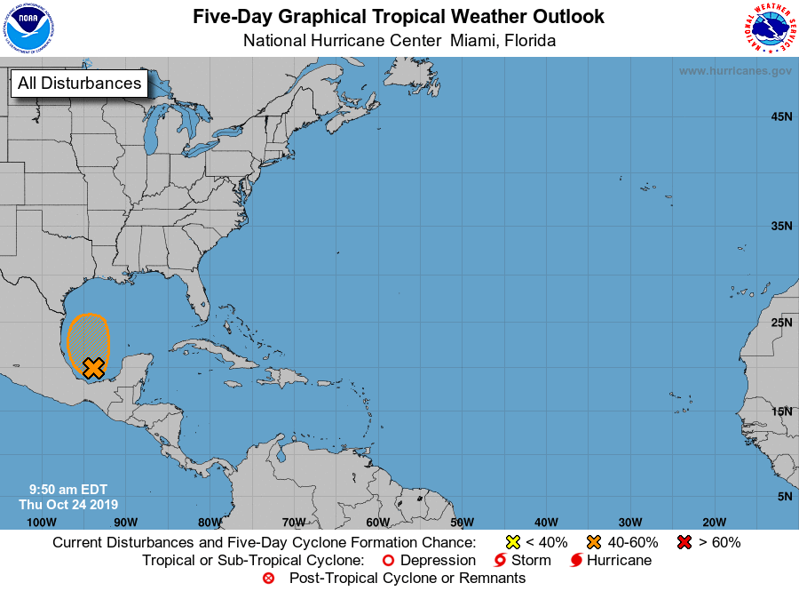
1. Early morning visible satellite images indicate that the
circulation of the low pressure area in the Bay of Campeche has
become a little better defined.  The associated showers and
thunderstorms continue to show signs of organization, and this
system could become a short-lived tropical depression before it
merges with a cold front by late Friday.
* Formation chance through 48 hours...medium...50 percent.
* Formation chance through 5 days...medium...50 percent.

Forecaster Cangialosi


List of Atlantic Outlooks (May 2023 - present)
List of East Pacific Outlooks (May 2023 - present)
List of Central Pacific Outlooks (May 2023 - present)
List of Atlantic Outlooks (July 2014 - April 2023)
List of East Pacific Outlooks (July 2014 - April 2023)
List of Central Pacific Outlooks (June 2019 - April 2023)
List of Atlantic Outlooks (June 2009 - June 2014)
List of East Pacific Outlooks (June 2009 - June 2014)