Skip Navigation Links
NOAA NOAA United States Department of Commerce

NHC Graphical Outlook Archive


« Earliest Available         ‹ Earlier         Later ›         Latest Available »
GIS Shapefiles
Central Pacific Eastern Pacific Atlantic

View 2-Day Graphical Tropical Weather Outlook
Click for Eastern Pacific Click for Eastern Pacific

Tropical Weather Outlook Text

ZCZC MIATWOAT ALL
TTAA00 KNHC DDHHMM

Tropical Weather Outlook
NWS National Hurricane Center Miami FL
800 PM EDT Wed Oct 23 2019

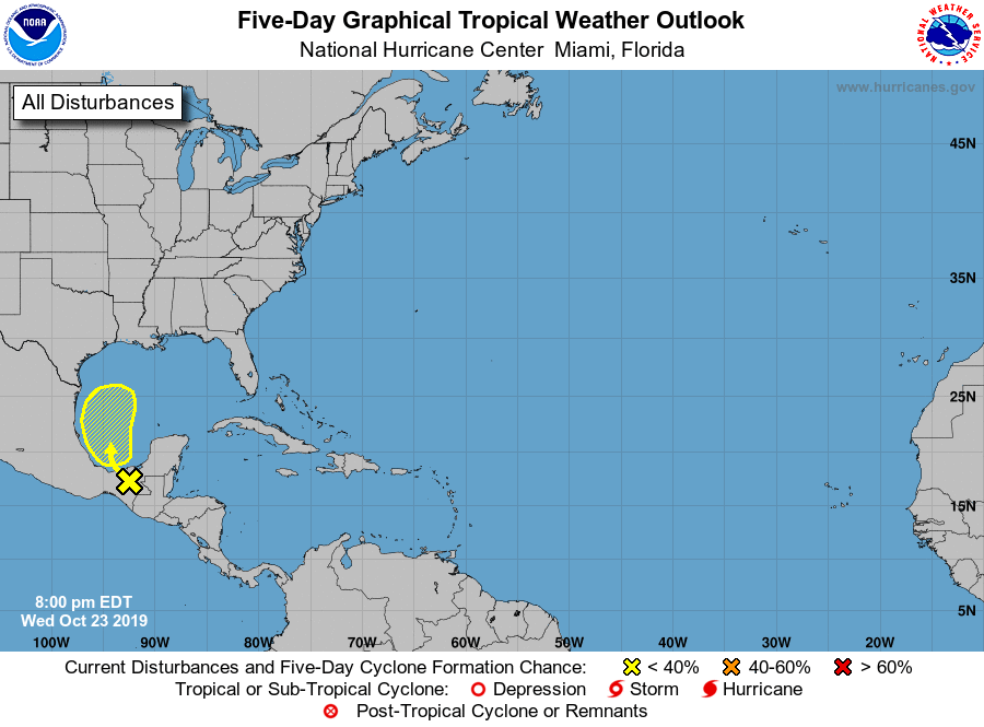
For the North Atlantic...Caribbean Sea and the Gulf of Mexico:

1. A broad area of low pressure associated with a tropical wave is
producing disorganized showers and thunderstorms over southern
Mexico, Belize, Guatemala, and the southwest Gulf of Mexico. Some
development of this system is possible during the next couple of
days while it moves generally northwestward and then northward over
the western Gulf of Mexico. The system is then forecast to merge
with a cold front over the weekend.
* Formation chance through 48 hours...low...20 percent.
* Formation chance through 5 days...low...30 percent.

Forecaster Zelinsky


List of Atlantic Outlooks (May 2023 - present)
List of East Pacific Outlooks (May 2023 - present)
List of Central Pacific Outlooks (May 2023 - present)
List of Atlantic Outlooks (July 2014 - April 2023)
List of East Pacific Outlooks (July 2014 - April 2023)
List of Central Pacific Outlooks (June 2019 - April 2023)
List of Atlantic Outlooks (June 2009 - June 2014)
List of East Pacific Outlooks (June 2009 - June 2014)