ZCZC MIATWOAT ALL
TTAA00 KNHC DDHHMM
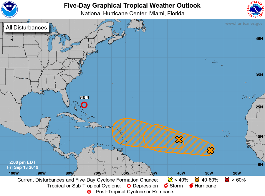
Tropical Weather Outlook
NWS National Hurricane Center Miami FL
200 PM EDT Fri Sep 13 2019
For the North Atlantic...Caribbean Sea and the Gulf of Mexico:
The National Hurricane Center is issuing advisories on Potential
Tropical Cyclone Nine, centered over the central Bahamas. This
system is gradually becoming better organized, and if this trend
continues, a tropical depression or tropical storm may develop later
this afternoon or evening as the system drifts northwestward.
* Formation chance through 48 hours...high...90 percent.
* Formation chance through 5 days...high...90 percent.
1. A tropical wave located about midway between the Cabo Verde Islands
and the Lesser Antilles is producing a large but disorganized area
of cloudiness and showers. Conditions are expected to become more
conducive for development in a couple days, and a tropical
depression could form early next week while the system moves
westward across the tropical Atlantic and approaches the eastern
Caribbean Sea.
* Formation chance through 48 hours...low...20 percent.
* Formation chance through 5 days...medium...50 percent.
2. Another tropical wave is located several hundred miles southwest of
the Cabo Verde Islands. Gradual development of this system is
possible during the next several days, and a tropical depression
could form early next week while it moves westward across the
tropical Atlantic.
* Formation chance through 48 hours...low...near 10 percent.
* Formation chance through 5 days...medium...40 percent.
Public Advisories on Potential Tropical Cyclone Nine are issued
under WMO header WTNT34 KNHC and under AWIPS header MIATCPAT4.
Forecast/Advisories on Potential Tropical Cyclone Nine are issued
under WMO header WTNT24 KNHC and under AWIPS header MIATCMAT4.
Forecaster Latto