ZCZC MIATWOAT ALL
TTAA00 KNHC DDHHMM
Tropical Weather Outlook
NWS National Hurricane Center Miami FL
800 PM EDT Sun Jul 28 2019
For the North Atlantic...Caribbean Sea and the Gulf of Mexico:
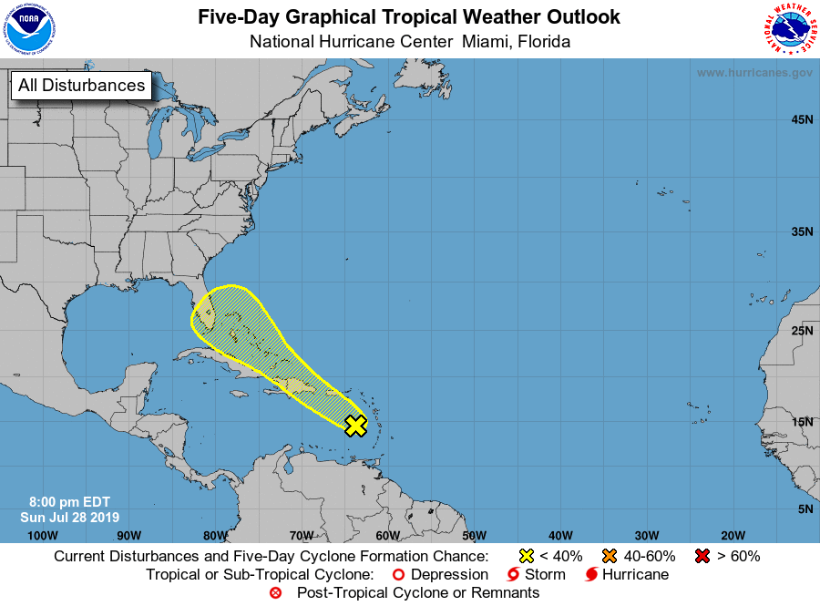
1. A persistent area of cloudiness and thunderstorms located over the
eastern Caribbean Sea is associated with a tropical wave. This
disturbance is expected to move west-northwestward to northwestward
across the north-central Caribbean Sea during the next few days,
producing locally heavy rainfall and possibly some flooding across
portions of the Lesser Antilles, Puerto Rico and Hispaniola. Little
development of the disturbance, however, is likely during this time
as upper-level winds are becoming less conducive. The system is
forecast to move near or over the Straits of Florida or the Bahamas
by the end of the week where environmental conditions could be a
little more conducive for development.
* Formation chance through 48 hours...low...10 percent.
* Formation chance through 5 days...low...20 percent.
Forecaster Beven