ZCZC MIATWOAT ALL
TTAA00 KNHC DDHHMM
Tropical Weather Outlook
NWS National Hurricane Center Miami FL
800 PM EDT Fri Jul 12 2019
For the North Atlantic...Caribbean Sea and the Gulf of Mexico:
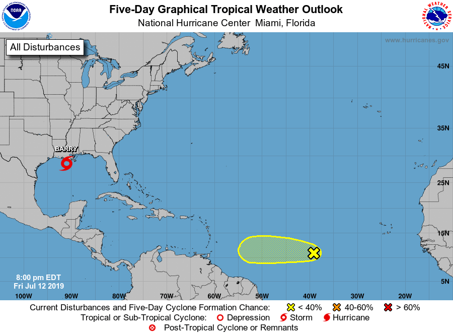
The National Hurricane Center is issuing advisories on Tropical
Storm Barry, located just south of the Louisiana coast.
1. Shower activity has become less organized since yesterday in
association with a tropical wave located about midway between the
Cabo Verde Islands and the Windward Islands. Any development of the
wave is expected to be slow to occur during the next few days while
the system moves westward at 15 to 20 mph. Environmental conditions
are expected to become unfavorable for development by early next
week.
* Formation chance through 48 hours...low...10 percent.
* Formation chance through 5 days...low...20 percent.
Forecaster Blake