ZCZC MIATWOAT ALL
TTAA00 KNHC DDHHMM
Tropical Weather Outlook
NWS National Hurricane Center Miami FL
200 AM EDT Fri Jul 12 2019
For the North Atlantic...Caribbean Sea and the Gulf of Mexico:
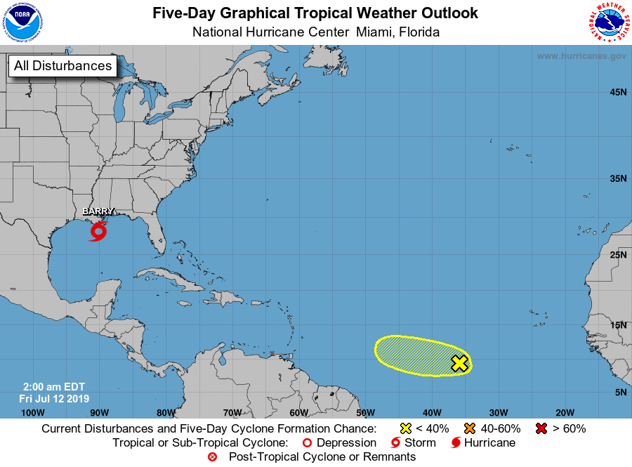
The National Hurricane Center is issuing advisories on Tropical
Storm Barry, located about 80 miles south-southwest of the mouth of
the Mississippi River.
1. Showers and thunderstorms associated with a tropical wave
located several hundred miles southwest of the Cabo Verde Islands
have become a little better organized during the past several
hours. Some additional development of the wave is possible during
the next day or two while it moves westward at 15 to 20 mph before
environmental conditions become less favorable over the weekend.
* Formation chance through 48 hours...low...20 percent.
* Formation chance through 5 days...low...20 percent.
Forecaster Roberts