ZCZC MIATWOAT ALL
TTAA00 KNHC DDHHMM
Tropical Weather Outlook
NWS National Hurricane Center Miami FL
Issued by the NWS Weather Prediction Center College Park MD
200 PM EDT Tue Jun 4 2019
For the North Atlantic...Caribbean Sea and the Gulf of Mexico:
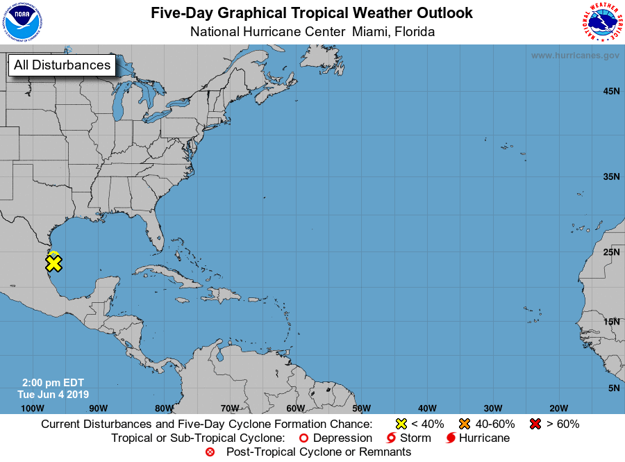
1. Recent satellite imagery indicates that a broad area of low pressure
located over the southwestern Gulf of Mexico remains disorganized.
This system is expected to move inland over northeastern Mexico
later today or tonight and the chances of development into a
tropical depression have decreased. The Air Force Reserve
reconnaissance mission scheduled for today has been canceled.
Regardless of development, the disturbance will likely produce heavy
rainfall over portions of eastern Mexico, southeastern Texas and the
Lower Mississippi Valley during the next few days. For more
information about the rainfall threat in the United States, please
see products issued by your local forecast office and the Weather
Prediction Center.
* Formation chance through 48 hours...low...20 percent.
* Formation chance through 5 days...low...20 percent.
Forecaster Pereira/Roth/Zelinsky