ZCZC MIATWOAT ALL
TTAA00 KNHC DDHHMM
Special Tropical Weather Outlook
NWS National Hurricane Center Miami FL
130 PM EDT Mon May 20 2019
For the North Atlantic...Caribbean Sea and the Gulf of Mexico:
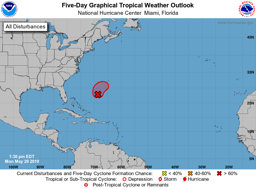
1. Showers and thunderstorms associated with a broad area of low
pressure located several hundred miles southwest of Bermuda are
showing signs of organization. Although recent satellite wind data
suggest that the system currently lacks a well-defined center of
circulation, environmental conditions are expected to be conducive
for the formation of a short-lived subtropical or tropical cyclone
later today or tonight. Conditions are forecast to become
unfavorable for further development by late Tuesday, and the
disturbance is expected to merge with a cold front on Wednesday.
An Air Force Reserve reconnaissance aircraft is currently en route
to investigate the disturbance. Interests in Bermuda should
monitor the progress of this system. The next Special Tropical
Weather Outlook will be issued by 8 PM EDT today.
* Formation chance through 48 hours...high...70 percent.
* Formation chance through 5 days...high...70 percent.
Forecaster Brown