ZCZC MIATWOAT ALL
TTAA00 KNHC DDHHMM
Special Tropical Weather Outlook
NWS National Hurricane Center Miami FL
730 PM EDT Sun May 19 2019
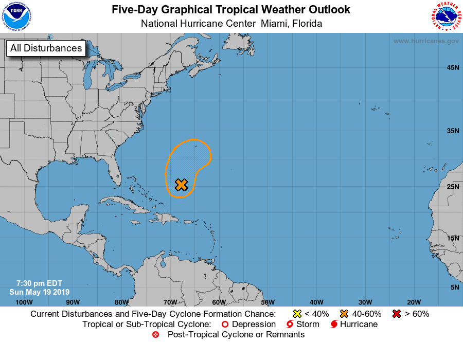
For the North Atlantic...Caribbean Sea and the Gulf of Mexico:
1. An area of low pressure is expected to form several hundred miles
southwest of Bermuda by Monday. This system could develop into a
short-lived subtropical or tropical cyclone late tomorrow or
Tuesday while moving northward or northeastward. By Wednesday,
however, conditions are forecast to become unfavorable for further
development, and the system should become rapidly absorbed by a
cold front. An Air Force Reserve reconnaissance aircraft is
scheduled to investigate the disturbance Monday afternoon, if
necessary. Interests in Bermuda should monitor the progress of this
system. The next Special Tropical Weather Outlook will be issued by
Monday 2 AM EDT.
* Formation chance through 48 hours...medium...50 percent.
* Formation chance through 5 days...medium...50 percent.
Forecaster Avila