ZCZC MIATWOAT ALL
TTAA00 KNHC DDHHMM
Tropical Weather Outlook
NWS National Hurricane Center Miami FL
700 AM EST Fri Nov 23 2018
For the North Atlantic...Caribbean Sea and the Gulf of Mexico:
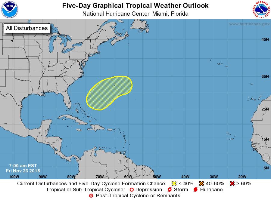
1. A complex, non-tropical low pressure system is forecast to develop
over the southwestern Atlantic by Saturday. The system is expected
to move eastward to east-northeastward over the western and central
Atlantic through the middle of next week and could acquire some
subtropical characteristics during that time. Regardless of any
subtropical development, winds to gale force are expected over
portions of the western Atlantic during the next couple of days and
are possible over the central Atlantic by early next week.
Additional information can be found in High Seas Forecasts issued by
the National Weather Service. Interests in Bermuda should monitor
the progress of this system.
* Formation chance through 48 hours...low...near 0 percent.
* Formation chance through 5 days...low...30 percent.
High Seas Forecasts issued by the National Weather Service are
issued under AWIPS header NFDHSFAT1, WMO header FZNT01 KWBC, and
are available on the Web at
https://ocean.weather.gov/shtml/NFDHSFAT1.shtml.
Forecaster Zelinsky