ZCZC MIATWOAT ALL
TTAA00 KNHC DDHHMM
Tropical Weather Outlook
NWS National Hurricane Center Miami FL
100 AM EST Fri Nov 23 2018
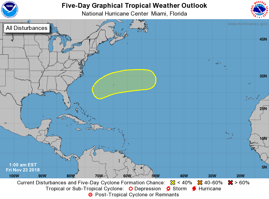
For the North Atlantic...Caribbean Sea and the Gulf of Mexico:
1. A complex, non-tropical low pressure system is forecast to develop
off of the southeastern coast of the United States by Saturday. The
low is then expected to move eastward to east-northeastward over
the warm waters of the western and central Atlantic through the
middle of next week, possibly acquiring subtropical characteristics
by the time the low passes near or over Bermuda on Sunday. Interests
in Bermuda should monitor the progress of this developing weather
system over the next few days.
* Formation chance through 48 hours...low...near 0 percent.
* Formation chance through 5 days...low...30 percent.
Additional information on this system can be found in High Seas
Forecasts issued by the National Weather Service, under AWIPS header
NFDHSFAT1, WMO header FZNT01 KWBC, and available on the Web at
https://ocean.weather.gov/shtml/NFDHSFAT1.shtml.
Forecaster Stewart