ZCZC MIATWOAT ALL
TTAA00 KNHC DDHHMM
Tropical Weather Outlook
NWS National Hurricane Center Miami FL
100 PM EST Tue Nov 13 2018
For the North Atlantic...Caribbean Sea and the Gulf of Mexico:
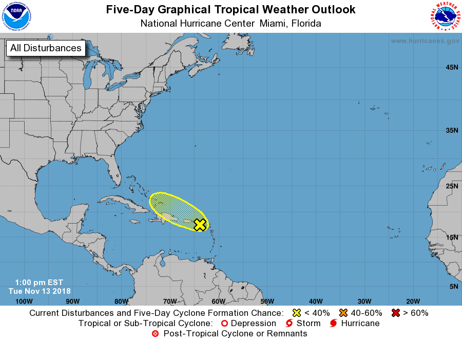
1. Disorganized showers and a few thunderstorms extending from the
Leeward Islands to Puerto Rico are associated with a tropical wave
interacting with an upper-level low. Significant development of
this system is not expected due to unfavorable upper-level winds and
interaction with the islands of the Greater Antilles. Regardless of
development, this system is expected to bring locally heavy rainfall
to portions of the Leeward Islands, the Virgin Islands, and Puerto
Rico over the next couple of days as it moves generally westward to
west-northwestward.
* Formation chance through 48 hours...low...10 percent.
* Formation chance through 5 days...low...20 percent.
Forecaster Brennan